


Morton Simpson Community Center, Jefferson County, Alabama
About
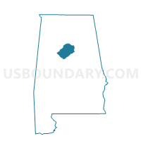
Outline

Summary
| Unique Area Identifier | 522030 |
| Name | Morton Simpson Community Center |
| County | Jefferson County |
| State | Alabama |
| Area (square miles) | 1.81 |
| Land Area (square miles) | 1.81 |
| Water Area (square miles) | 0.00 |
| % of Land Area | 100.00 |
| % of Water Area | 0.00 |
| Latitude of the Internal Point | 33.53769650 |
| Longtitude of the Internal Point | -86.78147410 |
Maps


Graphs
Select a template below for downloading or customizing gragh for Morton Simpson Community Center, Jefferson County, Alabama


Neighbors
Neighoring Voting District (by Name) Neighboring Voting District on the Map
- Avondale Public Library, Jefferson County, AL
- Harriman Park Recreation Center, Jefferson County, AL
- Hudson Middle School, Jefferson County, AL
- Inglenook Elementary School, Jefferson County, AL
- Jefferson County Courthouse, Jefferson County, AL
- Mountain Park First Baptist Church, Jefferson County, AL
- North Avondale Branch Library, Jefferson County, AL
- Norwood Community Center, Jefferson County, AL
- Southtown Housing Community Center, Jefferson County, AL
- Willow Wood Recreation Center, Jefferson County, AL
Top 10 Neighboring County Subdivision (by Population) Neighboring County Subdivision on the Map
Top 10 Neighboring Place (by Population) Neighboring Place on the Map
Top 10 Neighboring Unified School District (by Population) Neighboring Unified School District on the Map
Top 10 Neighboring State Legislative District Lower Chamber (by Population) Neighboring State Legislative District Lower Chamber on the Map
Top 10 Neighboring State Legislative District Upper Chamber (by Population) Neighboring State Legislative District Upper Chamber on the Map
Top 10 Neighboring 111th Congressional District (by Population) Neighboring 111th Congressional District on the Map
Top 10 Neighboring Census Tract (by Population) Neighboring Census Tract on the Map
- Census Tract 24, Jefferson County, AL (3,629)
- Census Tract 16, Jefferson County, AL (3,390)
- Census Tract 4, Jefferson County, AL (3,338)
- Census Tract 5, Jefferson County, AL (2,864)
- Census Tract 3, Jefferson County, AL (2,735)
- Census Tract 7, Jefferson County, AL (2,577)
- Census Tract 55, Jefferson County, AL (2,167)
Top 10 Neighboring 5-Digit ZIP Code Tabulation Area (by Population) Neighboring 5-Digit ZIP Code Tabulation Area on the Map
- 35217, AL (13,729)
- 35212, AL (11,539)
- 35207, AL (9,010)
- 35222, AL (7,884)
- 35234, AL (6,311)
- 35203, AL (3,798)
- 35233, AL (1,308)